
AlgoSLAM
Operate scanning and collect data from your phone.
Downloads AlgoSLAM →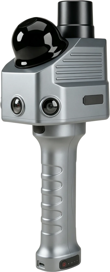
HANDHELD 3D MAPPING
Combine INS and SLAM for handheld 3D mapping, true-color point clouds and desktop post-processing. RTK comes as standard.
Discuss your applicationFROM CAPTURE TO POINT CLOUDS
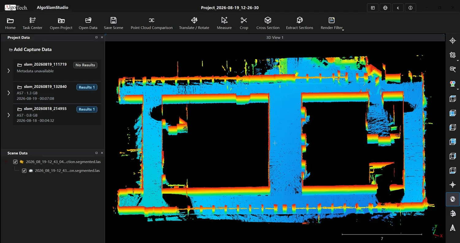
Inspect captured geometry and refine point clouds with desktop post-processing.
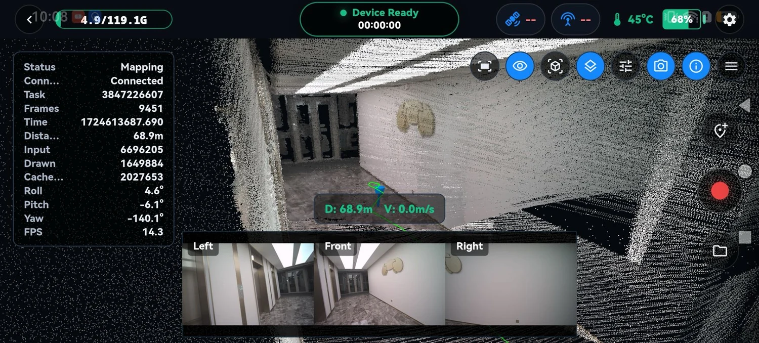
Three cameras capture color information to complement the scanned geometry.
TECHNICAL OVERVIEW
System, sensing and connectivity specifications at a glance.
Request technical details →| Absolute accuracy | 3 cm |
|---|---|
| Relative accuracy | 1 cm |
| Power supply | Handle battery |
| Scanning time per battery | 4 hours |
| Data storage | 128 GB |
| Weight including battery | 1.23 kg |
| Operating temperature | −20 °C ~ +50 °C |
| Ingress protection | IP52 |
| Laser safety | Class 1 |
|---|---|
| Ranging distance |
0.2–40 m (10%) 70 m (80%) |
| Maximum effective measurement rate | 192,000 points/s |
| LiDAR field of view | 360° (H) × 40.5° (V) |
| Cameras | 3 |
| Camera resolution | 2.3 MP |
| Satellite constellations | GPS / GLONASS / BeiDou / Galileo / QZSS |
|---|---|
| RTK | Standard |
| IMU frequency | 200 Hz |
| Gyroscope bias | 0.5 °/h |
| Wi-Fi | 2.4 GHz / 5 GHz |
|---|---|
| USB Type-C | Direct connection to a phone or computer |
Specifications are from the AS7 datasheet. Accuracy test conditions are not specified there; contact our team to confirm suitability for your application.
COMPANION SOFTWARE
Operate scanning and collect data from your phone.
Downloads AlgoSLAM →Desktop point-cloud post-processing for further refinement of captured data.
Downloads AlgoStudio →LET’S BUILD SOMETHING PRECISE